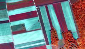
A geographical information system is an essential part of an Integrated Administration and Control System (IACS) implementation. Supporting a Land Parcel Identification System (LPIS), our system can be used from within the institution and made publicly available if desired.
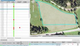
Our GIS infrastructure is built so that it can run on both high-end (blades) and low-end (PC clusters) servers. Furthermore, we have developed a number of integrated applications for administration and control, such as: Farm Registry, LPIS, On-the-spot controls. Components of the applications can handle, for example, land consolidation, meliorations, disease outbreak, forestry and others.