Mobile GIS

Mobile GIS fully supports the process of the on-the-spot checks in accordance with the IACS regulatives. It is a powerful GIS software running on Windows CE and Windows Mobile. Mobile GIS provides support for inspectors when reviewing, evaluating and resolving irregularities on the field.
Main features of Mobile GIS:
- Synchronizing data with the laptop
- Choosing a farm
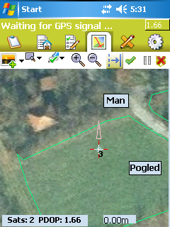
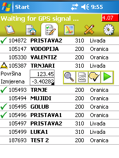
- Previewing data (aerial photography, application data, controls from previous years, current measurement data, photos)
- Choosing a reference parcel with quick graphical preview
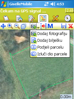
- Field measurement (repeated measurements, boundary and illegible area measurement, tracking mode, PDOP value limited measurements for appropriate quality, spliting polygons, shifter measurements)
- Recording photos
Gallery