Register of Geodetic Monuments

The geodetic monuments have the key role when planning and deciding about any interventions into environment (in urban or rural regions) or for monitoring the changes caused by man or natural processes.
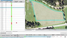
They are necessary for accurate positioning of parcels or objects taken into consideration. The geodetic monuments are included into the system of triangular nets of different levels (density from a few hundred meters, up to a few kilometers), which are the groundwork for positioning, calculations and measurements. The accuracy and up-to-date managing of geodetic points is of great importance, therefore Sinergise development team produced the application to support these tasks lead by governmental institutions.
Gallery