How to use open satellite imagery in support of mountain sports - Copernicus Data Space Ecosystem Webinar
In our company, many of us love mountain sports. Whether it's mountaineering, rock climbing, mountain biking, paragliding, or landscape photography, mountains are often the talk in the kitchen and the corridor, and we regularly host team-building events in the mountains. We also love satellite imagery and often share photos of our favorite places with each other. But there is more to mountains and satellite data than first meets the eye. Have you ever planned your trip using the latest satellite images? Or shared your route with friends overlaid on a satellite photo? Have you thought of embedding the latest satellite imagery in the smartphone outdoor mapping application you use? We hope to show you how all this can be done, and why it can help you stay safe and enjoy the adventure even more. Join our next Copernicus Data Space Ecosystem webinar on 23 July at 14:00 CEST.
Don't worry, this webinar will be much less technical than our usual training sessions. We specifically want to include those who have never looked at a satellite image before. So, see you soon, register here:
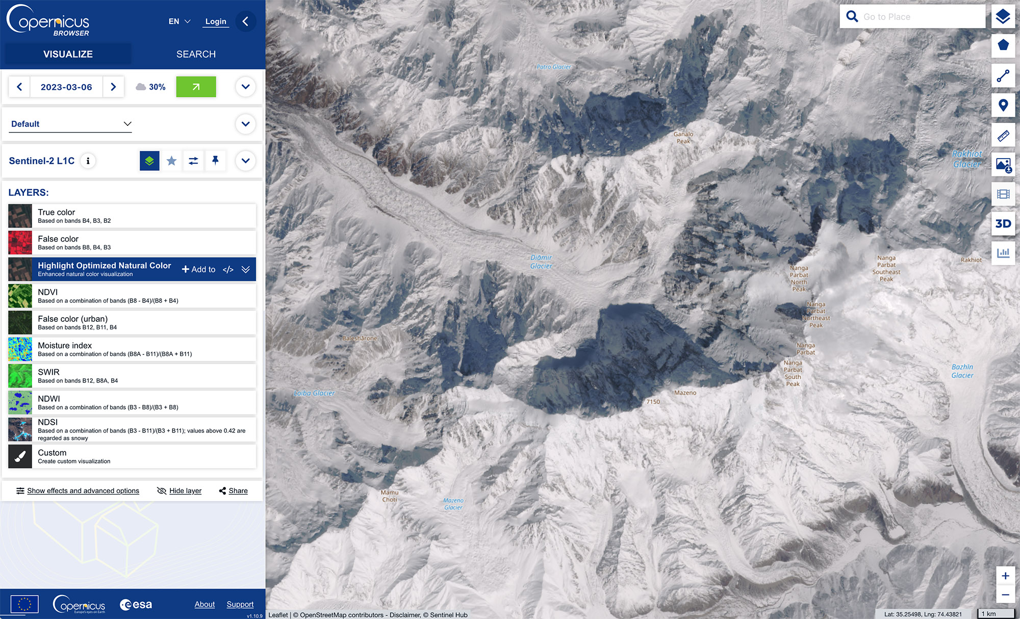
Copernicus Sentinel-2 L1C image acquired on 6 March 2023.
---
Visit the Copernicus Data Space Ecosystem YouTube channel to watch the recordings of all CDSE webinars.