UDENE Project Kick-Off
Submitted by editor on
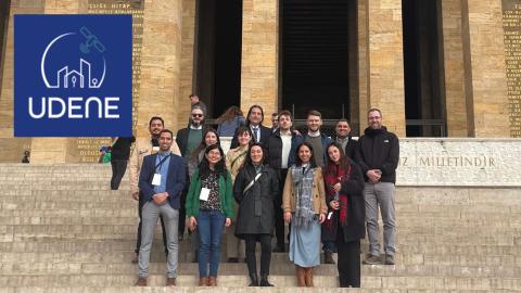
From 12th to 14th of February, UDENE consortium met in Ankara, Turkey, to kick-off this new project. Funded through the HORIZON Europe 2022 Space calls managed by EU Agency for the Space Programme (EUSPA); the project will last until January 2026. UDENE, standing for Urban Development Explorations Using Natural Experiments, gathers 9 partners, from 6 countries including Tunisia, Turkey, Serbia, Italy, France, and Slovenia, to build sustainable urban environments addressing the challenges posed by increasing urbanisation and the effects of climate change.