Query Planet - AI for EO at Scale

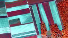
Join our webinars dedicated to Query Planet, an ESA-funded and PhiLab-supported project that aims to facilitate the use of Artificial Intelligence (AI) algorithms to build large-scale Earth Observation applications exploiting Sentinel-2 and commercial data sources. The goal of the project is to create and open-source AI solutions that tackle state-of-the-art and compelling EO challenges. These use-cases build on the Sentinel Hub service and the open-source eo-learn library.
Introduction
In the first webinar on March 24th 2022 at 14:00 CET (13:00 UTC), we will provide you with an overview of the use-cases developed, namely super-resolution technology for optical sensors, forest and tree species mapping of Europe, and efficient object detection at scale. For each use-case we will outline technical details and the created open-sourced material, e.g. data, code, models, which will be described more in detail in the second hands-on webinar. Knowledge of machine learning and deep learning will help the understanding of the algorithms, although this is not a prerequisite.
General agenda:
- Project motivation and aim
- Super-resolution of Sentinel-2 time-series imagery
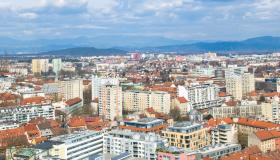
- Pan-European forest and tree species mapping using Sentinel-2 imagery
- Efficient object detection using multi-scale satellite imagery
- Open-sourcing the use-cases
Speakers:
- Nicolas Longepe, ESA
- Julien Cornebise, Why-How
- Benjamin Bischke, Vision Impulse
- Devis Peressutti, Sinergise
Register for the first webinar here!
Building an Application
The second webinar on April 7th 2022 at 14:00 CEST (12:00 UTC) will be a hands-on tutorial on how to set-up and execute the use-cases developed within the project. For each use-case, description of the required data and code will be provided, as well as demonstration of how to run the code. The use-cases are developed with the open-source eo-learn library and will be available on the eo-learn-examples GitHub repository. Knowledge of Python, machine learning and deep learning will help the understanding of the code, although this is not a prerequisite.
General agenda:
- Hands-on: Super-resolution of Sentinel-2 time-series imagery
- Hands-on: Pan-European forest and tree species mapping using Sentinel-2 imagery
- Hands-on: Efficient object detection using multi-scale satellite imagery
Register for the second webinar here!
We also invite you to visit our webinars page with more information about our previous webinars and future events. Subscribe to our webinars mailing list and get all the information on time.