New tools and datasets in the Copernicus Data Space Ecosystem
The Copernicus Data Space Ecosystem is the one-stop-shop for accessing Earth Observation data from the Copernicus Programme. This portal combines direct access to the full archive and new datasets of Sentinel data with a plethora of code and GUI-based analysis tools and onboard server capacity for conceptualization and development. The Ecosystem was kicked off in January 2023 and continues to grow with added functionality.
Copernicus Browser is the main platform for viewing satellite imagery in the Copernicus Data Space Ecosystem. This interface provides access to Sentinel-1, Sentinel-2, Sentinel-3 and Sentinel-5P data, but recently also Copernicus Digital Elevation Models and cloudless WorldCover annual Sentinel-2 mosaics. Visualization options in the Browser include default and custom composites, together with a repository of diverse custom scripts and image editing tools. The Browser supports various ways for downloading images, including low-resolution quick looks, detailed analytical datasets, time series animations or selections of raw data files. With this capability, it has all it takes to become the tool of choice for educating people about Earth Observation. It even runs on smartphones!
API services of the ecosystem allow streamlined in-code access to those who want to open or market applications on top of Sentinel data. These tools are structured to make the process of drafting, testing, upscaling and marketing EO data products as efficient as possible. The new Jupyter Lab, the QGIS Plugin and openEO offer additional entry points.
The Jupyter Notebooks service is is an online environment that provides immediate access to the Copernicus Data Space Ecosystem data and API-s. Jupyter notebooks offer an interactive web-based coding environment for Python, also allowing display of text, dynamic graphics, and maps. Jupyter is widely used as a platform for scientific coding and operational algorithm development for EO. The Copernicus Data Space Ecosystem Jupyter Notebooks service is curated with common EO-related and Geospatial Python Libraries pre-installed. This removes the need to download data or configure an environment of your own with all the libraries’ dependencies . A set of example notebooks enable step-by-step learning, from initial data access to full processing pipelines. This platform also opens new possibilities in EO education.
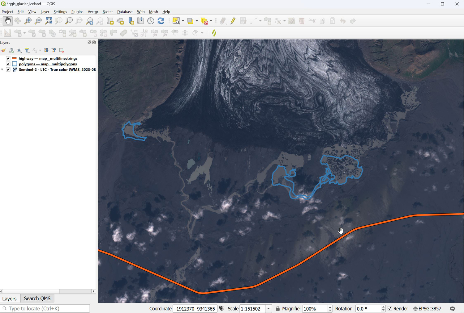 Figure 1: Haolduksvisl Glacier, Iceland with roads and meltwater lakes from OpenStreetMap overlain. https://sentinelshare.page.link/fYRq
The Sentinel Hub QGIS plugin integrates the functionality of the Copernicus Browser directly into the most popular open-source desktop GIS. QGIS has a broad user community from GIS enthusiasts to government agencies. The OGC API of the Data Space provides the ability to create web services to dynamically serve raster data within GIS software including QGIS. To make this as efficient as possible, the plugin provides an intuitive graphical interface to search for imagery based on sensor, date and location, and to directly overlay with the user's own GIS datasets. Users can apply the default visualization tools available in the Browser or create new configurations of their own. By enabling vector data operations in direct comparison with satellite data, the plugin enhances the exploitation of Copernicus satellite imagery.
openEO introduces a new way of creating data analysis pipelines independently from coding language, with a cross-platform datacube concept. This set of APIs is available for Python, R and JavaScript, providing easy ways for data integration into existing workflows. The API system is complemented by the openEO Web Editor, a graphical interface similar to Model Builder, where users can query data and link analysis modules to create a processing chain or execute services directly in their browser without installing additional software. This web editor also enables tracking ongoing jobs and visualizing results. The Algorithm Plaza is a hub for hosting algorithms built on openEO, allowing users a centralized system for exploring available tools and running tests assessing their suitability for specific use cases.
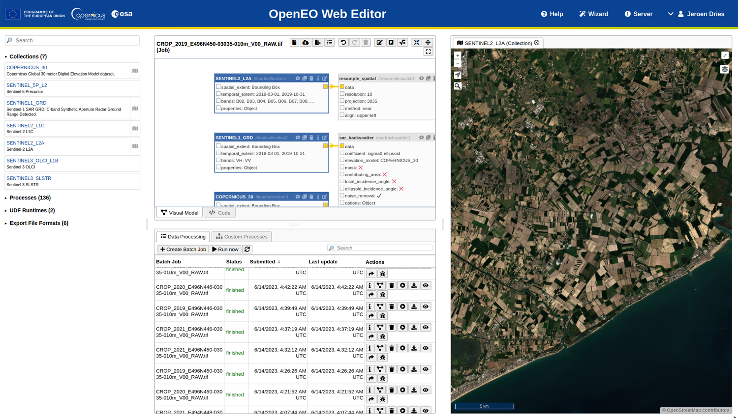 Figure 2: an example of the openEO Web Editor
Parallel to these developments, the existing gateway to Sentinel data, the Copernicus Open Access Hub is gradually ramped down, with all services closing on 31 October 2023. Image data download will work in a similar way from the Copernicus Data Space Ecosystem, but for most applications, it is more efficient to implement APIs into cloud-based analysis pipelines, significantly reducing the volume of data to move. A detailed transition guide is available here.
Learn more about the Copernicus Data Space Ecosystem from this video and stay follow updates on the news site.
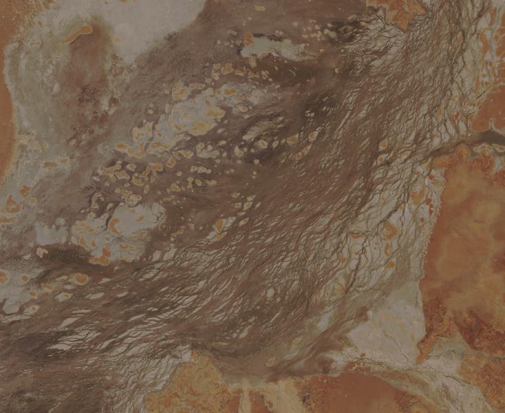
Banner: Sentinel-2 image of Cooper Creek, Queensland, Australia https://sentinelshare.page.link/dSmb